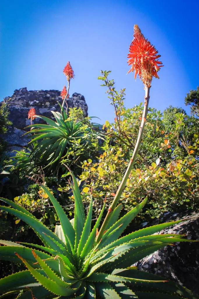
Guide Thabelo Sekome was unruffled by my sensory vertigo. He’s taken enough people up to the top of Mariepskop to know they need a few moments to gush, exclaim, or stand in awe of the vistas, the fynbos, the aloes or the proteas, “although I first fell in love with the trees in the mistbelt forest lower down the mountain; the Outeniqua yellowwoods (Afrocarpus falcatus), the Transvaal oak (Brachylaena rotundata), and the cabbage trees (Cussonia spicata),” he said.
While millions of tourists’ gaze at Mariepskop from the scenic vantage points of Mpumalanga’s Panorama Route, or the Lowveld towns of Hoedspruit and Kampersrus, relatively few summit this landmark that is part of the northern reaches of the Drakensberg range, which measures 1945 metres above sea level at its highest point.
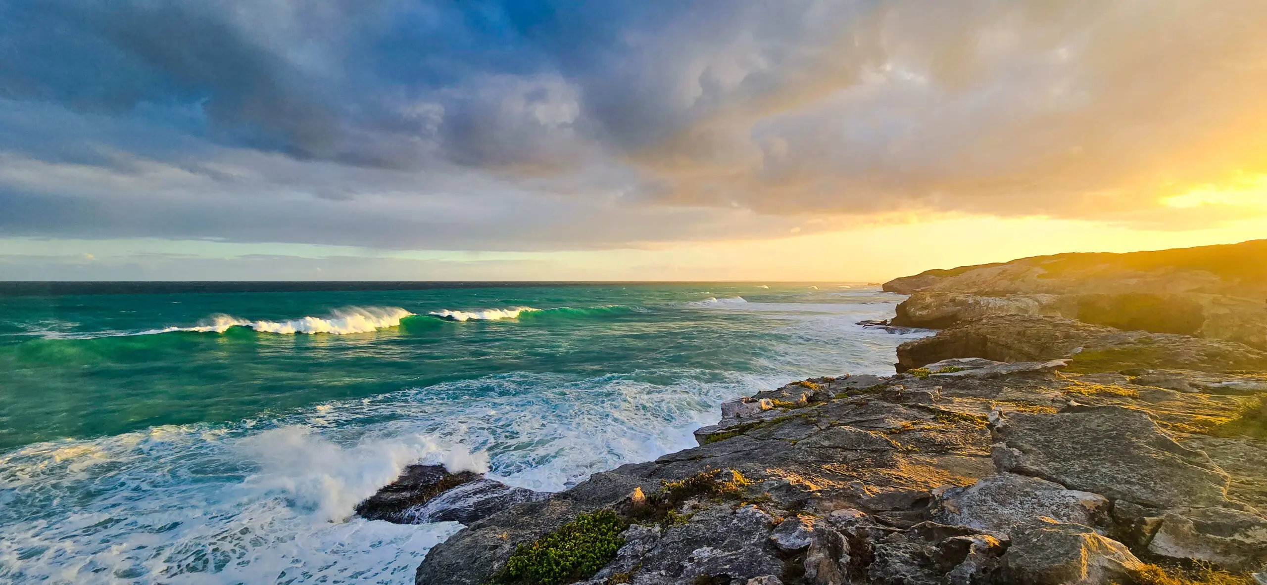
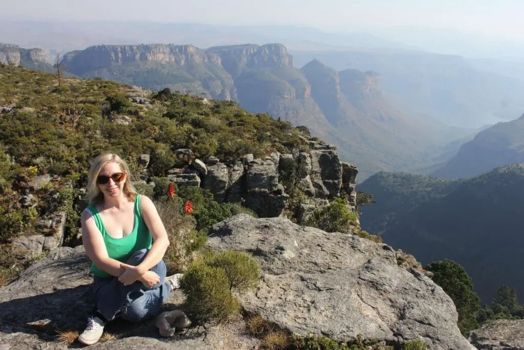
The celestial views – better than from God’s Window and the Three Rondavels – into the heart of the Blyde River Canyon are breath-taking, but the mountain is also a miracle of ecology, a national strategic water source area, a centre of endemism and, as of 20 August 2021, officially part of the newly expanded Blyde River Canyon Nature Reserve.
While not quite the national park proposed more than a decade ago, the reserve has almost doubled in size from 24 446 hectares to 44 566 hectares. It links portions of state-owned forests on the escarpment to create an enlarged protected area that includes Mariepskop, thanks to a pioneering collaboration between the ‘Blyde Four’ Communal Property Associations that have successfully claimed the land, Mpumalanga Tourism and Parks Agency (MTPA), and various local NPOs and government departments.
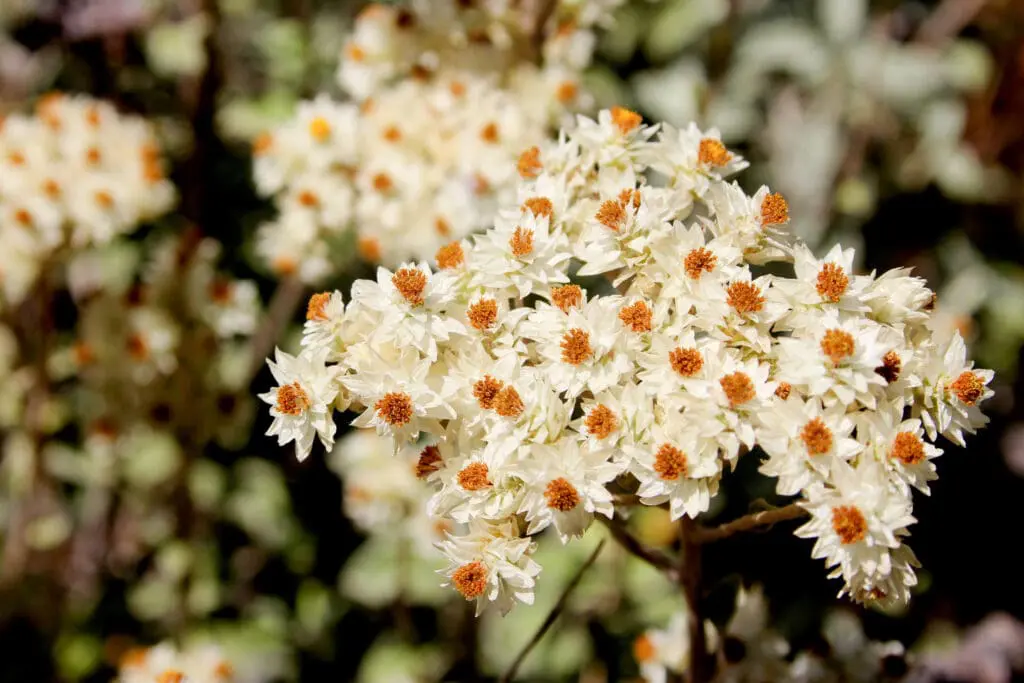
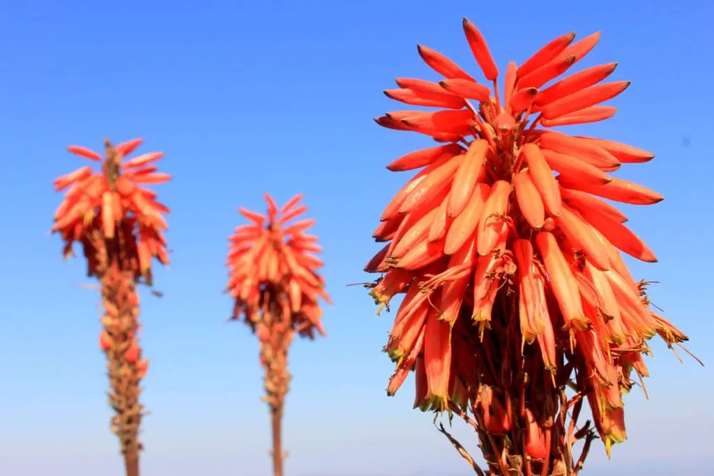
On the summit, Thabelo’s Belgian colleague Jochen van de Perre calmly laid-out coffee, croissants, and home-made banana bread while I enthused over the tangles of old-man’s beard on the branches of the wind-stunted real yellowwoods (Podocarpus latifolius) weathered rocks tattooed with vibrant lichens, hot pink protea blooms (Protea rouppelliae) and the silver slivers of the endemic Helichrysum mariepscopium.
“I felt the same, the first time I saw the canyon from this side,” the lodge owner confirmed, laughing at my inability to sit still in the face of such wild beauty. He’s one of a handful of tourism operators in the area that works with a few local guides like Thabelo to offer tours up Mariepskop. He’d driven us from his lodge, Kruger Cliffs, up the steep 1100 metre ascent past dusty pine plantations, through lush forest to this flinty, scented wonderland of sharply eroded rocks, and views for days.
Formed after a massive volcanic disturbance in central Mpumalanga millions of years ago that produced the mighty Mpumalanga Drakensberg escarpment, Mariepskop has been many things to many people; fortress for the Mapulana, who staved off repeated Swazi attacks in the 19th Century, site of conflict and heartbreak, when communities were forced to move for large scale industrial timber plantations, and an apartheid era military radar station.
Now, as a nature reserve, its new custodians must navigate a history as rutted and complex as the road we’d driven with Jochen, that took us past abandoned buildings, alien trees and tangled forest paths.
Sitting on a rocky ledge with alpine swifts soaring below, and the aroma of coffee mixing with the aromatic scent of Synocolostemon albiflorus (part of the mint family), Thabelo talked about his relationship to the mountain, and the events that have shaped how people feel about it. “My father’s uncle grew up here, and our family was the last to leave in 1978. We call it Mapisaneng – place of chiefs,” he explained, recounting how Chief Maripi and his Sotho-speaking people took ownership of “the great one”, or Thaba ya Moholoholo, as the mountain is also known, and used it as a stronghold in clashes with the Swazi nation.
Despite his links to the area, he only went up Mariepskop for the first time in the early 2000s, since before that, access was restricted. “I first learnt about the mountain in stories from my great uncle, the hunter Njejane, who could follow a baboon along the sheer cliffs and crevices,” he recalled. He then spent time with birding guru Dave Rushworth, tree authority Mervyn Lötter, and countless other experts intrigued by the area’s ecology, hydrology and geomorphology.
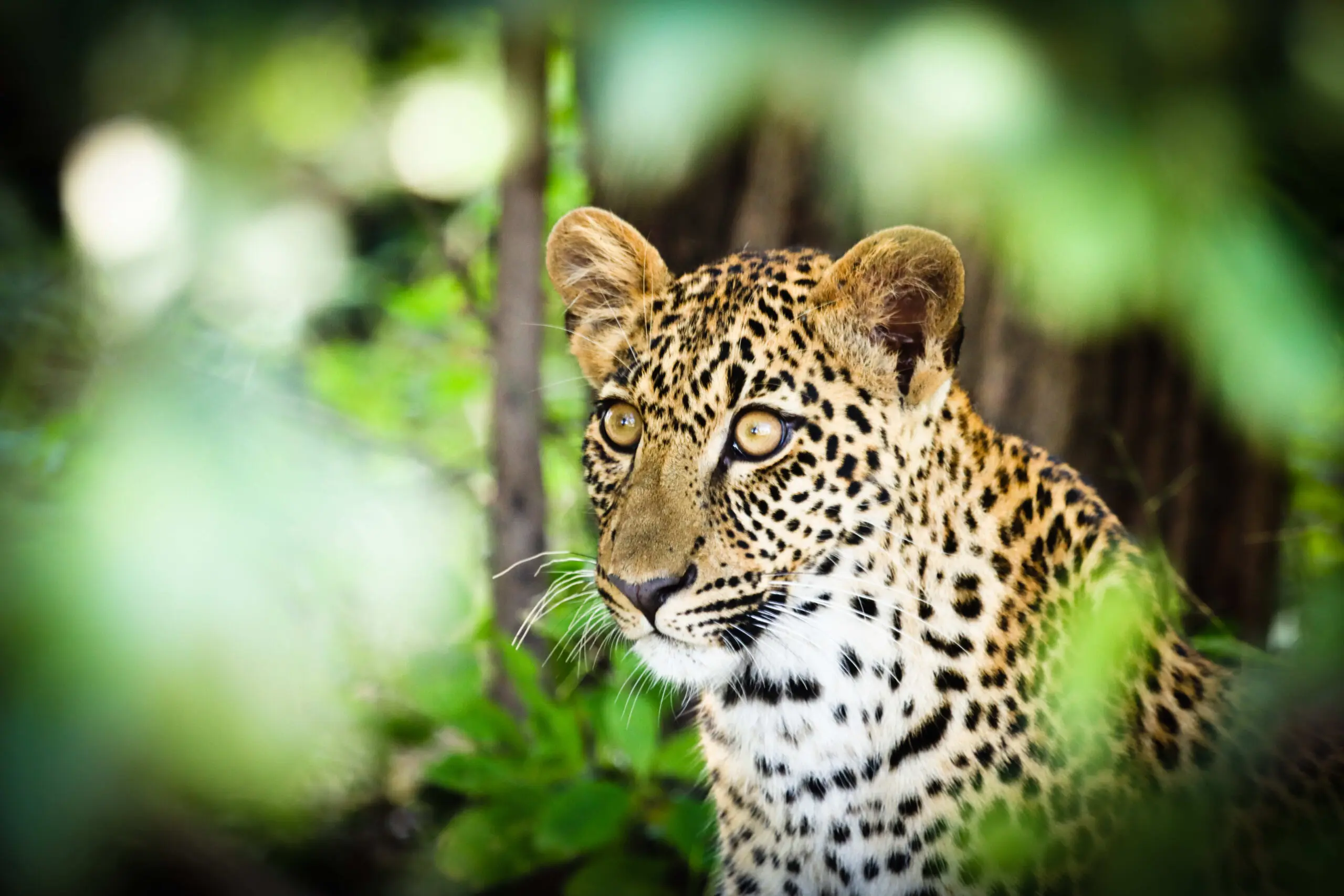
There’s a lot to learn on this mountain; nowhere else in South Africa can you move from mistbelt forest to fynbos in minutes, and tick a Narina trogon or a Gurney’s sugar bird just a kilometer apart. And from the top or on the slopes, there is always a chance of a flyby of an elusive Taita falcon or, perhaps, a peregrine falcon, the fastest bird in the world. He has seen caracal, porcupines and even kudus on its summit, while lower down in the mistbelt, there are Samango monkeys, secretive leopards and bushpigs…
These days, you’re also likely to encounter illegal loggers, people hunting with packs of dogs, and poachers after rare plants. While the loggers are mainly taking pine and eucalyptus trees, Thabelo says seven yellow woods have recently been ring barked. And the last known surviving cycad specimen of the Mariepskop variety of Encephalartos laevofolius was poached in 2005 in an incident that still fills him with rage. “I found that cycad soon after I started guiding. It was the last one known on the mountain, growing just down here,” he said, pointing down a precipitous ravine.

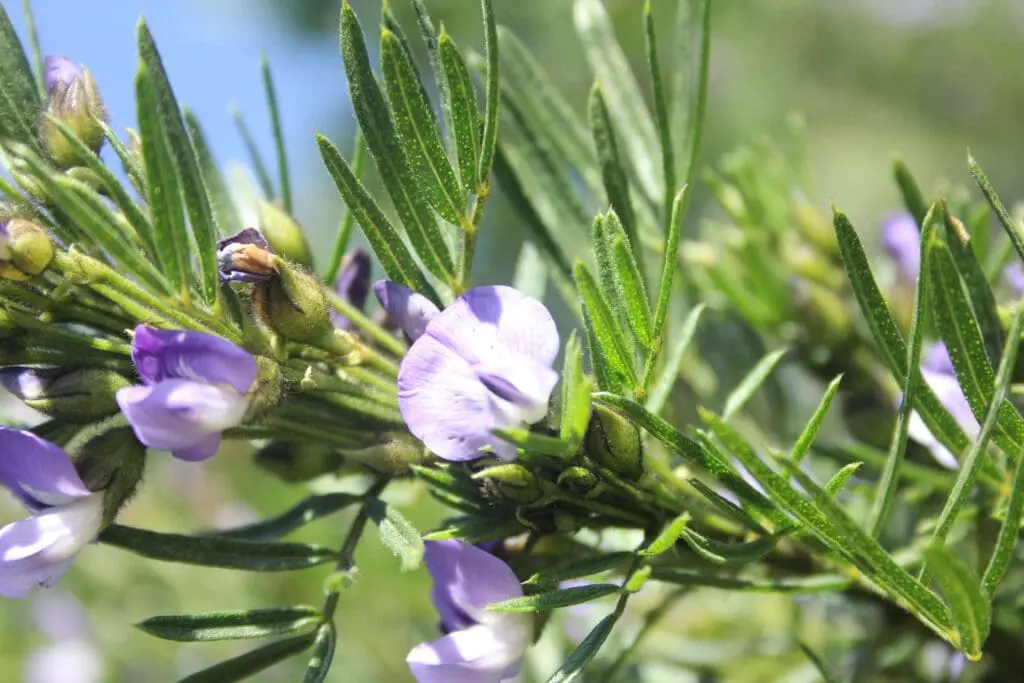
The cycads are gone, but there are at least 1 400 plant species recorded in the Mariepskop complex alone, and more than 1600 recorded species in the Blyde River Canyon Nature Reserve. The landscape is topographically complex, which is why there are so many habitats in the reserve, including plateaux covered with plants similar to Cape fynbos, aloes and proteas, wetlands and sponge areas, grassland slopes, afromontane forest, riparian forest, moist woodlands, dry woodlands and shrublands. You don’t have to be a botanist either to appreciate the endemic clivias, wild agapanthus, rare ferns, lichens, and the fire lily. The mistbelt forest, and little-explored kloofs on the southern or southeastern slopes, are verdant treasure troves of trees, shrubs, lianas and epiphytes, with more species likely to be discovered when they’re properly explored.
But some places are magical because they’re difficult to reach or little-known, and the fact that it’s a hard mountain to find information on, unless you know someone who knows someone, has always been part of its charm for locals from Hoedspruit and Kampersrus. Some climb it, but many just ignore the bad roads, and venture up to fill their souls on the mountain top. The fact that nobody I spoke with was quite sure who is responsible for the telecommunication towers at the top, or who looks after the old military buildings, or why many of the hiking trails are so overgrown that even Thabelo’s been lost and had to sleep up there, seem to add to its allure.
In the last year though, illegal logging and poaching have escalated, and the reserve’s custodians are worried, because there are now too many people doing their own thing on the mountain. “The legal recognition of Mariepskop as part of the Blyde reserve is a huge step forward, but our excitement has been tempered by what’s happening right now. And we have no money and no capacity for the security, the infrastructure, or the restoration work the new part of the reserve needs,” says MTPA’s Brian Morris.
The current staff – about a dozen forestry employees – remain at the Mariepskop base camp and issue access permits to visitors, but in the last year, syndicates have moved in, vandalised property and threatened forestry officials elsewhere in the reserve, exacerbated by the fact that many were wholly absent from the mountain during the Covid 19 lockdowns, which created a kind of vacuum.
There are plans to develop tourism infrastructure, but for now, the two chalets on the mountain are in need of repair, and access is an ongoing issue, although the road – notoriously bad on the mountain’s lower slopes – was being fixed in places when we went up. “I think the municipality had Public Works come in,” said Brian, explaining the many state players involved in managing the Mariepskop complex. In general though, it’s not accessible to the average tourist in a rental car.
When exploring, it’s easy to forget that protection – and even access for visitors – rests on this tangle of institutional arrangements with roots deeply entwined in historic conflicts, apartheid military ambitions, forced removals and the hopeful narrative of tourism, jobs and development that accompanied more recent land claim processes, but has largely failed to deliver.
“Around 2006/2007, we could smell the money on this mountain,” says Thabelo, who as a member of the Sehlare CPA, was involved in early field work and data collection around the land claims process. His love of the mountain is undiminished, but his early optimism has lessened. He farms tomatoes now, because tourism doesn’t pay his bills.
“It’s been 20 long years, the land claims are still not completely finalised, and not many of the jobs linked to tourism have emerged, nor have the jobs lost when the sawmills closed, been replaced,” confirms Brian, whose anxiety about how to fund the work needed is matched by his belief in Mariepskop’s huge potential to create jobs through restoration projects, tourism and other enterprises.
The mountain is utterly spectacular, and utterly unique, with wilderness lovers, trail runners, hikers, birders, botanists and lepidopterists travelling from around the country and the world to experience its beauty and diversity. At the end of the day though, it may be water, not tourism, that saves it.
The area gets 1000 – 2000 mm rainfall per annum, and this water from the catchment feeds into the Blyde Dam which supports a multi-million-rand agricultural sector around Hoedspruit. The Kruger National Park and associated private game reserves rely on the water from the mountain to recharge their rivers, and supply households in Hoedspruit, Phalaborwa and Bushbuckridge. The water filters down through unique peatlands that act as water towers, soaking up rain, which slowly percolates through rocky cracks into the mistbelt forest below.
“It’s incredible to think that the entire Lowveld depends on the mountain for water,” said Nick Theron, from the Kruger to Canyon Biosphere Region (K2C). As a key partner to MTPA and the four CPAs, K2C’s deeply involved in conservation efforts, restoration efforts and planning for the sustainability of the reserve. They’re currently trying to develop a water fund and get downstream users to contribute to the mountain’s conservation costs by valuing the ecosystem services the mountain provides. They have also been coordinating and driving efforts to clear much of the pine and eucalyptus plantations developed in the wider escarpment area since the 1930s.
Each alien tree uses up to 25 litres of water per day, but in recent years, the Blyde Restoration Group (a coalition of partners), has cleared thousands of hectares of alien invasive plants with at least another 6000 hard-to-reach hectares within the reserve’s boundaries to go. About 4000 hectares below the reserve boundary will be retained for commercial logging – if the syndicates leave anything behind.
Despite MPTA’s security concerns, to date visitors to the mountain have largely been left to their own devices. Huge areas still seem undiscovered, untouchable, and unknowable, where rare species like the Mariepskop dwarf chameleon, the Three Rondavels flat gecko, and the endemic Marieps Charaxes butterfly live and die unseen in this incredible, interlinked ecosystem that spans the 572-1 945 metres between the top and bottom of the canyon.
On our way down the mountain, we stopped for a quick walk along the Bushpig Trail, one of the better-maintained hiking routes into the liminal, tangled forest. Here Thabelo is in his absolute element, conversing with the trees. We watched a cloud of butterflies – swallowtails, emperors and smaller blues and yellows fluttering and “mud-puddling”; sucking in fluids and nutrients – “they are just some of the over 285 species recorded in the area,” he said.
It was frustrating to not have more time to explore. As we wound our way down the mountain, my head full of what I hadn’t seen. My heart was full with what I had, and what might still be found.
When I said I would be back to explore further, Thabelo warned me that some trails double back, some are dead ends and others aren’t marked at all. They intersect, diverge, twist and turn. There is no straight route to the top, but it all begins with that first step.
Five ways to explore Mariepskop
1. Take a hike.
There are several trails on the mountain, like the Bush Pig Trail, but until signage improves, it’s best to go with a guide who knows the mountain. There are also hikes on the foothills of Mariepskop in the privately owned Franklyn Park (but they don’t go to the summit), and spectacular options in the Blyde River Canyon itself.
You can climb Mariepskop, but you need permission to cross private land to do so. There is only one route up, and that’s the route that the kids from the base on the mountain used to take down to school in Kampersrus.
Contact Thabelo Sekome or visit Mariepskop Hikes or contact the Hoedspruit Hiking Club
2. Rent a e-bike
Only the elite riders will likely make it up the mountain purely under their own steam, but you can rent an e-bike from Blyde Bikes in Hoedspruit, which makes things a little easier, although there are still some seriously steep up-hills. The route from the forestry gate all the way to the top ascends 560 metres over a distance of 5.4 kilometres, just watch your breaks on the way down. Contact Blyde Bikes.
3. Run it
The annual Kruger to Canyon Trail Run follows an epic route, starting behind the Mariepskop school, and following old trails that had to be rediscovered with the help of the oldest forestry guards and historic maps. There are sections with explosive views of the Lowveld and stunning waterfalls. It’s a challenging run that involves climbing up and over into the canyon, and then back up again, with technicalities created by roots and rocks that can get tricky and slippery. The event however really exposes people to what this beautiful mountain is about over either 25 or 42 kilometers.
Visit Kruger 2 Canyon Challenge.
4. Go boating
For a different perspective, the one-and-a-half-hour trip along the Blyderivierspoort Dam’s fascinating shoreline, overhung with wild figs, rubber euphorbia, milkwoods and waterberries, is great value for money. Built in 1972 on the confluence of the Ohrigstad and Blyde Rivers, the dam laps the lower slopes of Mariepskop, and it’s the easiest way to get close to interesting vegetation at the base of the canyon.
5. Take to the skies
Helicopter flights over the canyon are breathtakingly beautiful. Leaving from Hoedspruit Civil Airfield over the unfolding wonder of the Lowveld far below, you’ll soar above the Blyderivierspoor Dam near Swadini, view Bourkes Luck Potholes, the Three Rondavels from the air, and take in a number of spectacular waterfalls, cliffs and grasslands. Restrictions mean you cannot enter the canyon, but a helicopter flip is as close as you’ll get to an eagle’s eye-view of the landscape.
Where to stay
Kruger Cliffs’ modern, fully-equipped self-catering units provide guests with guaranteed privacy, individual splash pools, outdoor showers, and absolutely spectacular views of the mountain.
Umvangati House is a modern, mountain-side retreat where understated luxury is the order of the day and each window frames a masterpiece.
The Forever Resorts offer budget accommodation options at Swadini and along the Panorama Route at higher altitude along the rim of the canyon.